
Water Level Measurements 2019
 A digital pressure sensor was installed off a dock at the eastern end of the central part of Lake Mattatall in order to measure changes in water levels of the lake. The sensor operated from May 26 to October 28, 2019 and recorded water depths every 15 minutes for a total of 14,874 measurements. Results are shown in the following plot along with total rainfall amounts greater than 20 mm that were recorded nearby.
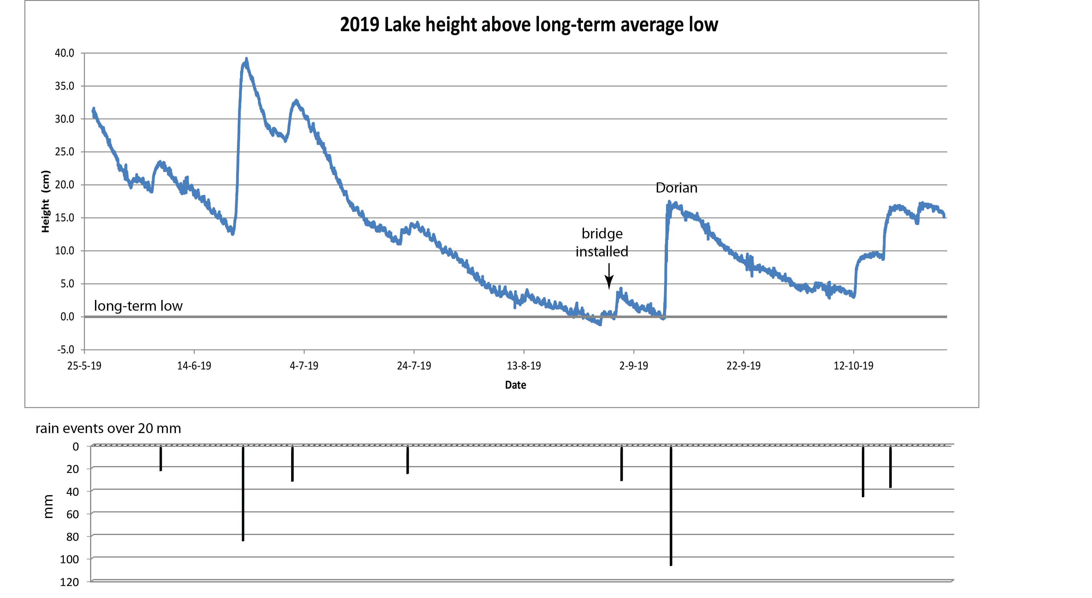
Water levels are shown relative to a long-term low-water average that has been monitored by Roger Sorsdahl in the northeastern part of the lake over several years. Overall, the plot shows a decrease of about 30-40 mm (12-16 in) over the drier summer months. Two large rainfalls occurred on June 21-22 and on Sept 7-8 (hurricane Dorian) and are associated with the largest increases in lake water heights. Note, however, that there are significant variations in the rise in level of the lake for these two rainfall events. The first event yields a lake level rise of 24.8 cm for a rainfall of 8.5 cm; while the second yield a lake rise of 16.9 cm for a rainfall of 10.7 cm. Such variations are due to differing amounts of water that flow into the lake from the surrounding watershed.
Also marked on the figure is the date that the new outlet bridge was constructed across Aqua Vista Rd. The purpose of the bridge is to return the lake back to a natural condition predating the building of the pipeline and subsequent road. Engineering studies determined that the larger opening of the bridge relative to the culvert would allow a much greater flow of water from the lake into the outlet stream at times of high water. At the same time, however, we wanted to leave unchanged the overall low-water level of the lake. The data clearly show that the base level has not decreased but instead has probably increased by a small amount (5 cm = 2 in). We will continue these measurements in 2020 in order to further assess the effects of the bridge.
